I got a kayak for my 50th birthday a couple of years ago — a red, 14-foot Perception Carolina, in case you’re interested in the specifics, with two dry wells — and I’ve been paddling a lot around our cottage north of Toronto, but I hadn’t brought it down to the city before until this fall. I thought I would bring it and see if there was enough to do with it to make it worthwhile, especially since we live near where the Rouge River feeds into Lake Ontario.
I’ve biked down the lake-front trail near our house to the mouth of the Rouge many times, and across the bridge into Pickering and along the bluffs out to Frenchman’s Bay, and I would often see kayaks and canoes coming down the river, and wonder where they had been. So one day I strapped the kayak to our old car and headed over to the Rouge.
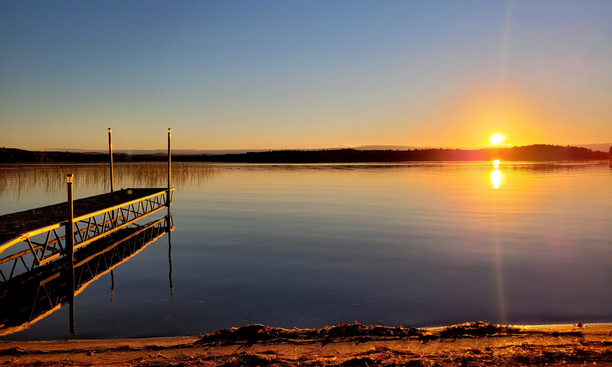
It was a beautiful sunny day, and I paddled around the marshes at the mouth of the river for a bit and saw some swans and Canada geese, some blue herons and some white egrets, and then I headed up-river. Unfortunately, I had chosen to go just a couple of days after a big rainstorm, and the river was running quite hard — I was fighting the current the whole way, and after about 45 minutes of hard paddling I could go no further. The ride back to the mouth of the river took me about 15 minutes.

The next time I went, it hadn’t rained for a week or so, and the river was about three feet lower at least — I could see the muddy water-line on the trees and bushes along the bank. Since I didn’t know how fast it would be going, I decided to put the kayak in at Glen Rouge campground, which is just north of Highway 401, off Kingston Road.
I carried it down to the water and dropped it in, and it was an easy paddle of 30 minutes or so down to the mouth of the river — so easy that after I got there, I decided to paddle all the way back up again. I saw more herons and egrets, and even saw a deer at one point in the woods. The most amazing part was that as soon as I got out of sight of the highway, I felt like I was out in the woods in the middle of nowhere. The banks of the ravine were so high I only saw one or two houses.
At one point, I saw a ruined old chimney and fireplace standing right near the bank, made of fieldstone and probably close to a hundred years old — whatever building it used to heat was large and two stories at least. I read that around the turn of the century, someone had tried to sell lots near the river to wealthy settlers, but didn’t sell many and eventually the land was taken over by the province.

Next to the chimney there was a sort of structure made of sticks tied together at the corners, with industrial-size plastic wrapping for walls and a ceiling. I got out to take a look, since the owner didn’t seem to be around, and inside was a cot and some boxes. Outside was a pot hanging from a tripod of sticks over a fire — and hanging from a wire near the chimney (which was tied to the structure) was a small crossbow. Obviously someone was living there, but I left before they returned.
I’ve been back a few times since, and the river is such a peaceful spot. And once when it was calm, I paddled out into Lake Ontario itself and followed the shore all the way out to Frenchman’s Bay and back again.
Since the weather was so beautiful in September, a friend who kayaks with a group out of Harbourfront in downtown Toronto asked me if I wanted to come for a sunset paddle with some of the group — and of course I said yes. We took the boats out into the harbour and across to the Toronto Islands, which I hadn’t been to since I was in my 20s. We paddled into the inland waterway that runs through and around the islands (there are about a dozen of them) and then back across the harbour just as the sun was setting.

It was such a great trip that when my friend asked me if I wanted to go for a longer paddle the next day, I said of course. I showed up at 10 a.m. and we left in a group of 15 or so, and paddled west along the shore through the Western Gap near the island airport, then turned north and paddled into the old Ontario Place grounds, and followed the waterway in and around some of the old buildings like the Cinesphere (where they used to show the first IMAX movies) and back out to the harbour.
After paddling back into the harbour, we went across to Ward’s Island, one of the largest of the islands, and pulled our boats up on the beach and headed inland to a small cafe there for a sandwich and some coffee. It was a beautiful spot — and then it was back into the boats and out around the eastern end of the island.

We paddled up the entire length of the Leslie Spit — a man-made promontory that sticks out into the lake near the end of the Don Valley Parkway — and turned around when we got to the lighthouse at the end. Everyone with a sailboat or any other kind of boat seemed to be out on the lake, which isn’t surprising since the weather was so gorgeous.
Then we came back down the side of the island and into the inland waterway again, and paddled in and around all of the islands, watching people sitting on their sailboats at the marina, or walking and biking around the laneways on the island. After seeing some swans near the island amusement park, we paddled back out the mouth of the inland waterway and across the harbour back to the boat-rental place. We were out for almost seven hours, and probably paddled about 25 kilometres or so.
All in all, it was a pretty amazing September for kayaking, and I’m glad I brought my boat down to the city — I’ve seen far more of Toronto’s rivers and lakes and islands than I ever knew existed.

Update: Years after I originally wrote this, I did a bit more research and found out where the chimney I saw came from, and also why the mouth of the Rouge River has so many little channels and dead-ends to it, unlike most river mouths. As Larry Noonan described in this piece, it turns out that an eccentric entrepreneur named Cecil White had a dream around the turn of the century that he called “Venice of the North,” which involved creating a paradise of beaches and estate homes along the Rouge River, complete with a Venice-style canal system and a small artificial lake.
White bought 700 acres or so, hired architects and started work, and he financed the project by building and selling homes along the river. At one point, according to a number of reports, there was a hotel on the side of the river called the Cowan Hotel, and the chimney is all that remains of it. White excavated the start of some canals and channels at the mouth of the river, and then came the stock market crash and the Great Depression, and the project stopped. He eventually raised some money and started it up again, but then the Second World War put a stop to development.
White got one more try when Highway 401 was built, which increased demand for homes near the Rouge River, but then he passed away. His wife continued the project, until Hurricane Hazel hit in 1954, and water levels in the valley rose so high they swept parts of the buildings and plenty of other material downstream, where it piled up against the bridge across the mouth of the Rouge. Eventually the bridge collapsed and all of construction materials and White’s dreams of a Venice of the North were swept out into Lake Ontario. The land near the river was expropriated by the province so that no one else could build there and now it’s part of Rouge Valley park.